
Geopolitics


“Everything that happens, happens somewhere.” – United Nations, 2015
Satellite technologies and applications have been evolving rapidly over the past two decades. We have realized that to improve life on Earth in the 21st century, we need to understand where people and things are located. This macro trend has been driven by the lower cost of access to space, increasing numbers of satellites in orbit, new sensor technologies, advances in AI capabilities, higher adoption of satellite-enabled devices, and the emergence of other Earth observation technologies such as drones and high-altitude platforms. As a result, the geospatial economy is now expanding into many new geographies and sectors. This has opened up an unlimited possibility space for the development of innovative applications which benefit government, business, and society. With new services and business models driving the commercialization of this potential, geospatial data has become the next frontier of technological infrastructure to enable better monitoring and insights for a wide range of applications across agriculture, environment, energy, health, education, finance, and security.
Space has been recognized as a domain of essential infrastructure for achieving the Sustainable Development Goals. As reported by the United Nations: “The importance of the role of Earth observation and geolocation in supporting the achievement of the development goals is recognized by the UN [...] space-based services and technologies are key in understanding climate change and during the full disaster management cycle” (United Nations, 2021a). This makes it particularly valuable for developing and emerging nations to harness the potential of geospatial technologies, as it could be an effective intervention to drive forward social and economic progress while also meeting global climate targets and safeguarding local ecosystems. Examples of this approach include using geospatial data to improve the management of natural resources and the administration of land-use (Goal 1: End Poverty), to enable smarter and more connected health services (Goal 3: Ensure Healthy Lives), to support policymakers in monitoring climate change and planning for natural disasters (Goal 13: Combat Climate Change), and to establish global standards for the sharing of geospatial data and expertise for evidence-based decision-making.
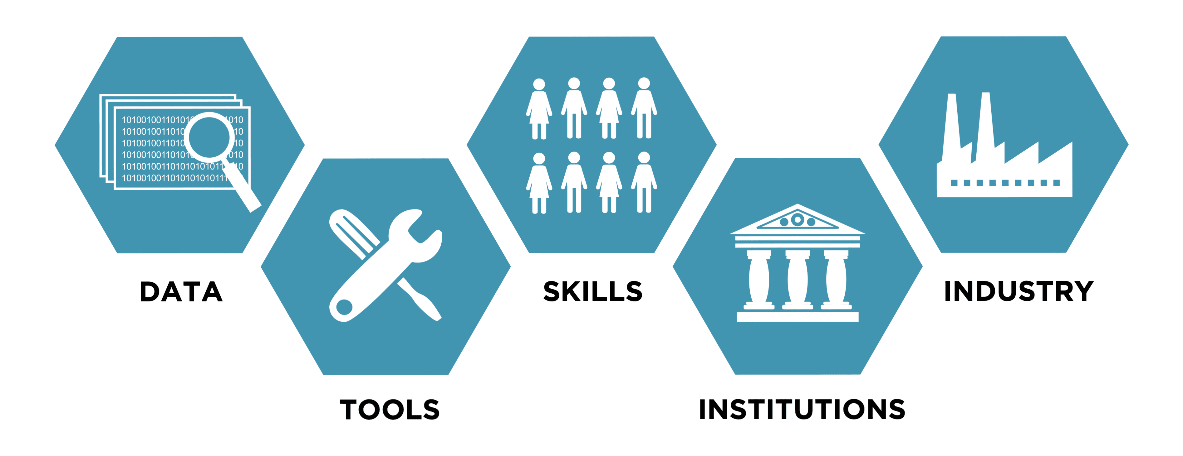
From a geopolitical perspective, space has also been recognized as a domain of critical national infrastructure (CNI). This stems both from the value of space infrastructure in providing access to global navigation, communications, and intelligence for international security, as well as from its importance in addressing civilization-scale challenges such as climate change, global conflict, and space weather. However, the adoption of new technologies in public institutions is a slow process, and the promotion of new technologies to be developed by the private sector can also be a difficult undertaking. Geospatial data has historically required a more specialized skillset than traditional digital solutions, though natural-language interfaces and geospatial foundation models are now rapidly lowering the barrier for non-expert users. This paper outline how geospatial technologies and applications can be advanced through five layers of geospatial policy: Data, Tools, Skills, Institutions, and Industry.
Geospatial Data
The first layer of geospatial policy captures the activities which are involved in creating and enabling access to the ‘raw material’ of the geospatial economy: data. This includes the generation of geospatial data through satellite imagery, aerial imagery, in-situ sensors, and geolocation data – as well as the platforms which people need to find and access the right data.
Satellite programs: The development of an Earth observation satellite constellation can offer significant economic benefits to emerging nations, providing the infrastructure which is needed to generate their own geospatial data and make it available to businesses and citizens. However, this is not yet recommended for developing nations, as a high level of resources is required to fund the capital costs and operating expenses of a satellite program. In those cases, alternatives such as data partnership agreements and commercial imagery acquisition should be considered. Examples of Earth observation satellite programs include the EU Copernicus Programme and NASA/USGS Landsat Program.
Aerial imagery program: The development of an aerial imagery program can be another valuable source of geospatial data, especially if it involves a framework for the acquisition of commercial drone imagery by the public sector. This can both be more cost-effective and offer a higher resolution of imagery than satellite programs, at the cost of having relatively limited geographic coverage and lower frequency of revisit times. An example of aerial imagery programs includes the US National Agricultural Imagery Program (NAIP).
Open-access data platforms: The establishment of an open-access platform for geospatial data can lower the costs of developing geospatial applications for businesses, as well as increase public interest in the use of geospatial data. This can be sourced from a nation’s satellite constellation, aerial imagery program, or commercial acquisition. In particular, the provision of analysis-ready data (ARD), such as through regional implementation of the Open Data Cube platform, can significantly lower the barriers to innovation. Examples of open-access data platforms include tech giants such as Google Earth Engine, the Microsoft Planetary Computer, and the AWS Open Data Registry, as well as national and regional initiatives such as the Copernicus Data Space Ecosystem, Digital Earth Australia, Digital Earth Africa, and the Swiss Data Cube.
Data acquisition programs: The establishment of a data acquisition program can be a powerful alternative for nations which would benefit from access to high-resolution imagery but do not have the resources to develop satellite or aerial imagery programs. This can involve acquisition from commercial providers or other national governments, as well as the development of ground stations which represent the essential space infrastructure to receive imagery and communications directly from satellites in orbit, such as South Africa’s Space Infrastructure Hub (SIH) initiative. An example of data acquisition programs includes the NASA Commercial Satellite Data Acquisition (CSDA) program.
Geospatial Tools
The second layer of geospatial policy captures the activities which are involved in providing the software that is needed to process and analyze geospatial data for a wide range of downstream applications. This includes tools which empower users to perform geospatial mapping, 2D and 3D modeling, remote monitoring, and resource management. Geospatial analytics platforms: The development of a geospatial data management, processing, and mapping platform can allow a wide range of users to perform analytics on satellite imagery and location data, empowering them to develop custom downstream applications. Examples of geospatial analytics platforms include Esri ArcGIS, OneMap Singapore, and the UN EO Toolkit for Sustainable Cities.
Geospatial data products: The development of geospatial data products for non-expert users can offer solutions in many areas, including climate change, supply chain monitoring, maritime logistics, urban infrastructure, humanitarian activities, and national security. If integrated into an open-access data platform, this could also be offered as a portfolio of geospatial modeling and analytics products through the ‘data cube’ model, following Digital Earth Australia. This could also offer dynamic models and simulations for specific use-cases. Examples of geospatial data products include the EU Copernicus Services and SERVIR-Amazonia.
Geospatial Skills
The third layer of geospatial policy captures the activities which are involved in educating and training a nation’s workforce to use geospatial data and tools. This includes programs for capacity-building through education, training, direct support, or knowledge exchange.
Geospatial education programs: The establishment of a geospatial education program for students and early-career STEM professionals can be an essential step to building the next generation of geospatial analytics skills. This is especially valuable for nations which aim to develop more capacity to harness the potential of satellite imagery and location data, starting at the level of primary and secondary education. Examples of geospatial education programs include the USGIF Academic Programs, Esri UK GeoMentor, Singapore MOE-EduGIS, ASEAN Geospatial Challenge, and Hexagon Education Programs.
Geospatial training programs: The establishment of a geospatial training program for both commercial and public sector individuals can increase the use of geospatial data in a wide range of industries, unlocking significant economic potential and enabling the development of downstream applications in new markets and across government. Examples of geospatial training programs include the EU’s EO4GEO Program, Africa’s Regional Center for Mapping of Resources for Development, and Esri Academy.
Geospatial capacity-building: The operation of a geospatial capacity-building initiative can benefit nations either through the one-way development of local resources and capabilities in geospatial analytics, or through the two-way exchange of knowledge between countries. This could involve an intergovernmental program co-funded by a geospatially developed nation to offer expertise to a geospatially developing nation, or a regional program to stimulate development among a group of countries. Examples of geospatial capacity-building initiatives include UNOSAT and the SERVIR network of regional knowledge centers across the Americas, Africa, and Asia.
Geospatial Institutions
The fourth layer of geospatial policy captures the activities which are involved in directing institutions to design strategies and coordinate geospatial activities. This includes the establishment of public institutions, geospatial strategy, policy frameworks, and efforts to raise awareness on the importance of geospatial data for government and industry.
Institutional design: The establishment of a dedicated geospatial body which coordinates policy and activities can be an essential foundation to developing the infrastructure, skills, resources, and activities which enable a nation to harness the potential of geospatial data and technologies. This could involve a new government agency with its own budget and mandate, or the inclusion of such a body within an existing department. Examples of institutional design include the Geospatial Commission in the UK and Geospatial Singapore.
Geospatial strategy: The design of a geospatial strategy which brings together academic, government, and industry perspectives to develop a multi-year plan can be a powerful way to define the vision and capacity-building activities at a global, regional, or national level. This could also involve an agenda on geospatial data ethics, following the model of the American Geographical Society’s Locus Charter (EthicalGEO, 2021), which can be seen as analogous to ongoing work in AI data ethics. Examples of geospatial strategy include the UN Geospatial Strategy (United Nations, 2021b), US Geospatial Data Strategy (US Department of State, 2018), UK Geospatial Strategy (Geospatial Commission, 2020), Singapore Geospatial Master Plan (Geospatial Singapore, 2018), and Canada’s Strategy for Satellite Earth Observation (Government of Canada, 2022).
Spatial data infrastructure: The development of spatial data infrastructure (SDI) at the national or regional level can provide the benefit of standardizing the formats and protocols for both access and interoperability of geospatial data. This could involve a coordinated framework of institutional arrangements, technology standards, and data policies which enable the discovery and use of geospatial data for a wide range of public and commercial stakeholders. Examples of spatial data infrastructure include the United Nations IGIF, EU INSPIRE, Arctic SDI, and South African SDI.
Innovation centers: The establishment of an innovation center can be an effective way to provide an institutional nexus and a physical location for collaboration between academia, industry, and government in the development of geospatial technologies and applications. This could involve a public private funding model, as well as greater focus on balancing the high-level overview perspective of satellites with engagement from local communities who represent the actual end-users of downstream applications. Examples of innovation centers include the Satellite Applications Catapult and GeoWorks Singapore.
Geospatial Industry
The final layer of geospatial policy captures the activities which are involved in supporting the innovation ecosystem, which drives the future of the geospatial economy. This includes programs which are designed to support early-stage companies, facilitate access to finance for business development, provide grant funding to commercialization projects, and promote geospatial innovation through challenges and competitions with prizes.
Business incubation centers: The establishment of business incubation centers which provide facilities, workshops, mentoring, and networking opportunities to early-stage geospatial companies can be a highly beneficial and cost-effective initiative to promote innovation and deliver business support. This could be set up as a national business incubation center, or a network of business incubation centers which focus on individual regions within a nation. It could also involve an accelerator program for more established companies and activities to stimulate engagement from the venture capital funding ecosystem. Examples of business incubation centers include the ESA Business Incubation Centres (BIC), US NGA Moonshot Labs, and UK Ordnance Survey Geovation.
Public funding programs: The establishment of a public funding program which provides grant funding for new projects in geospatial technologies and applications can be a simple way to promote innovation without requiring hands-on engagement. This could involve a portfolio of thematic calls which support the potential of geospatial data for addressing sustainable development goals, as well as a technology transfer program which helps companies to acquire and make use of existing intellectual property. Examples of public funding programs include ESA Business Applications, the UK Space Agency’s International Partnership Programme (IPP), and SmartEarth Canada.
Challenges and competitions: The organization of challenges and competitions which encourage both new and existing stakeholders to engage in innovation can be a highly effective way of leveraging the “power of incentive prize competitions” (Investing in Results, 2020). This could involve more industry oriented challenges to promote the development of new technologies and applications, or more public oriented competitions which foster interest in geospatial skills and spread awareness on the potential of geospatial data. Examples of challenges and competitions include the NASA Space Apps Challenge, Geospatial Commission Transport Innovation Competition, SANSA’s Africa EO Challenge, and the XPRIZE Foundation.
Geospatial Policy Roadmap
As a result of global best practices which have been identified for the five layers of geospatial policy – data, tools, skills, institutions, and industry – a set of recommendations can be made for geospatially developing nations. This is the basis of the Geospatial Policy Roadmap, which presents 8 steps that nations can take to advance their satellite technologies and harness the power of geospatial data for Earth intelligence.

When implementing these recommendations, it is important to consider the national context of each country when engaging in decision-making. While the sequence of policy initiatives above generally represents a flow from more governmental to more commercial activities, any of them can be implemented in parallel. For nations with limited capacity or resources, it is recommended to start with the policy initiatives which have relatively lower cost and time requirements: Geospatial Strategy, Education & Training, Business Incubation, and Challenges and Competitions. Policymakers are also encouraged to consider a wide range of factors including national priorities, institutional capacity of the public sector, economic resources in terms of available budget for government agencies and public funding programs, the nation’s military and security configuration along with any restrictions which may arise from this, the existing industry’s comparative advantage and innovation ecosystem, and any synergies that there may be with other initiatives or collaborations which are already ongoing.
Where new institutions would typically need to be established for a policy initiative, existing institutions can also be empowered with the budget and mandate to undertake those activities in the short-term. For example, a Geospatial Strategy could be designed by the national space or innovation agency, which can be observed in the US Federal Geographic Data Committee’s involvement in the Geospatial Data Act 2018 (Federal Geographic Committee, 2018). Alternatively, certain areas of implementation can be outsourced to third parties such as Google, Amazon, Microsoft, Esri, Carto, Mapbox, Hexagon, Maxar, Planet, Airbus, BlackSky, ICEYE, Umbra Space, Capella, UP42, Deloitte, Accenture, PwC, Arup, Mott MacDonald, Jacobs, Chemonics, and Palladium. At the international level, collaboration with the United Nations, World Bank, SERVIR Global, and the GEO community can also be beneficial to geospatially developing nations. However, the value of building local capacity and intellectual property is important to ensuring a sustainable geospatial industry, which also plays a factor into decisions over using open source vs. commercial platforms. Ultimately, it is recommended that proprietary solutions should be used as a short-term bridge, while a nation transitions towards developing more sovereign infrastructure and capabilities.
Satellite technologies have evolved from tools of state competition and scientific exploration into the invisible backbone of the global economy. The five layers of geospatial policy outlined in this paper: Data, Tools, Skills, Institutions, and Industry, provide a structured framework through which any nation can build the capacity to participate in this emerging domain, while the Geospatial Policy Roadmap offers a sequenced pathway to execute on this from initial strategy to sustainable industrial growth. For geospatially developing nations, this represents one of the highest-leverage interventions available to drive economic development, with a wide range of downstream applications across agriculture, environment, energy, aviation, maritime, transport, health, education, finance, and security. As space becomes embedded into national infrastructure, geospatial data is increasingly becoming the layer of intelligence on which 21st century governance, industry, and security will depend.
References
EthicalGEO. (2021). Locus Charter. Retrieved from https://ethicalgeo.org/locus-charter/ Federal Geographic Committee. (2018). Geospatial Data Act. Retrieved from https://www.fgdc.gov/gda
Geospatial Commission. (2020). Unlocking the power of location: The UK’s geospatial strategy 2020 to 2025. Retrieved from https://assets.publishing.service.gov.uk/government/uploads/system/uploads/attachmen t_dat a/file/894755/Geospatial_Strategy.pdf
Geospatial Singapore. (2018). Singapore Geospatial Master Plan. Retrieved from https://www.sla.gov.sg/qql/slot/u149/initiatives/Singapore-Geospatial-Master-Pla n.pdf
Government of Canada. (2022). Canada’s strategy for satellite Earth observation. Retrieved from https://asc-csa.gc.ca/eng/publications/canada-strategy-for-satellite-earth-observati on/02- contents.asp
Investing in Results. (2020). The power of incentive prize competitions. Retrieved from https://investinresults.org/chapter/power-incentive-prize-competitions United Nations. (2021a). Space supporting the Sustainable Development Goals. Retrieved from https://www.unoosa.org/oosa/en/ourwork/space4sdgs/
United Nations. (2021b). Geospatial strategy for the United Nations. Retrieved from https://www.un.org/geospatial/sites/www.un.org.geospatial/files/20210330_geospatial_s trate gy_for_the_united_nations-book.pdf
US Department of State. (2018). Geospatial data strategy. Retrieved from https://www.state.gov/geospatial-data-strategy/
FIND MORE